In its recently revised resource management plans for western Oregon, the Bureau of Land Management has identified 290 parcels of federal public lands, ranging in size from 0.01 to 440.2 acres and totaling 18,458.95 acres, as suitable for disposal. Although disposing of 0.7 percent of the approximately 2,600,000 acres of western Oregon BLM public lands may not seem like a big deal, many of these parcels have high public values.
Under the Federal Land Policy and Management Act, the BLM has classified its western Oregon lands into three zones:
• Zone 1 – Lands Suitable for Retention (219,953 acres)
• Zone 2 – Lands Suitable for Exchange (2,255,243 acres)
• Zone 3 – Lands Suitable for Disposal (18,459 acres)
Zone 1 includes designated and suitable wild and scenic rivers, wilderness areas, wilderness study areas, lands with wilderness characteristics, national trail corridors, areas of critical environmental concern (including research natural areas), any lands acquired using money from the Land and Water Conservation Fund, and the Yaquina Head Outstanding Natural Area.
Zone 3 lands are those that the BLM believes “are either not practical to manage or are uneconomical to manage because of their intermingled location and nonsuitability for management by another federal agency.” They may also be “survey hiatuses” (tiny wedges of land remaining in federal ownership due to survey errors when all the lands around them have gone out of the federal estate) or “unintentional encroachments” (unintended but unlawful intrusion on BLM land by a private landowner who thought the land was owned by her). The BLM prepared a Zone 3 map for western Oregon at the request of Senator Ron Wyden in 2013.
Zone 2 lands are all the parcels that are not in Zone 1 or Zone 3 and are “available for exchange to enhance public resource values, improve management capabilities, or reduce the potential for land use conflict.” Most, but not all, BLM lands in western Oregon are in a checkerboard ownership pattern where every other square mile or 640-acre section is public or private.
In many cases, Zone 3 lands have no significant public value. These parcels should be sold to the highest bidder, and the proceeds should be dedicated to the acquisition of high-public-value parcels to include in the federal estate in the same state.
In many other cases, Zone 3 lands have high public value and should continue in public ownership. The BLM should either retain ownership of these lands by reclassifying them as Zone 1 or transfer the parcels to other federal, state, or local land management agencies, with the condition that the lands be perpetually kept public and managed in the public interest.
Following are seven examples of high-public-value BLM Zone 3 lands in western Oregon that should be reclassified or transferred. The parcels in question are shown on the map segments to the left of their descriptions. I’m confident that a similar analysis of BLM eastern Oregon lands will yield similar examples.
In the Willamette River Greenway. The southern tip of Coon Island in the Multnomah Channel west of Sauvie Island in the Willamette River Greenway is a parcel of O&C lands classified in Zone 3. While the parcel is only 1.24 acres (slightly larger than an American football field), the rest of the island is the J. J. Collins Memorial County Park. The Zone 3 parcel should be added to the park, since a shortcoming of the beloved Willamette River Greenway is a lack of public land for recreational and habitat purposes. At least six other parcels of land are slated for disposal by the BLM in the Willamette River Greenway (O&C: 2, 2.79, and 5.42 acres; public domain: 0.17, 1.52, and 8.49 acres).

Along the Clackamas River Oregon Scenic Waterway. Three parcels of O&C lands (7.94 total acres) classified as Zone 3 are along the segment of the Clackamas River designated as an Oregon scenic waterway by a direct vote of the people in 1970. Perhaps the lands could be transferred to Oregon States Parks Department, which administers Oregon scenic waterways.

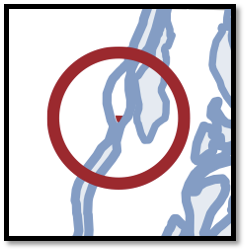
On national forest land. A 120-acre parcel of “BLM” land is not only surrounded by the Willamette National Forest (the green on the map) but is also actually in the Willamette National Forest. The BLM doesn’t own it but has nonetheless classified it as Zone 3.

With salmon and botanical values. Two O&C parcels (21.21 and 202.34 acres) classified as Zone 3 are slated for congressional protection under Senator Ron Wyden’s and Senator Jeff Merkley’s Oregon and California Land Grant Act of 2015 (S.132, 114th Congress) as part of the Illinois Valley Salmon and Botanical Area.

Adjacent to a national wild and scenic river. An 80-acre BLM public domain parcel that abuts the Chetco Wild and Scenic River, designated by Congress in 1988, and is bordered by the Siskiyou National Forest (in green on the map) is classified as Zone 3. Another parcel of BLM public domain land (in yellow on the map)—this one 40 acres square, east of the Chetco River, surrounded on three sides by Forest Service land—is just as far away from the BLM office, but the agency didn’t put it on the chopping block. These BLM lands should be transferred to the Forest Service—as should essentially all BLM lands in western Oregon.
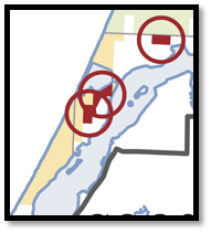
With rare coastal habitat. Two Zone 3 parcels of BLM land (92.78 and 96.15 acres) sit on the North Spit of Coos Bay adjacent to the Pacific Ocean. These parcels identified for disposal at directly adjacent to other BLM lands. They were identified for disposal not because they are isolated from other BLM lands and costly to manage, but because local interests lust after them for industrial development. A third Zone 3 parcel (80 acres) abuts not only the Siuslaw National Forest but also the Oregon Dunes National Recreation Area that Congress designated in 1974.

Orphans of history. Eight parcels of public domain land (7.6, 40, 111.5, 84.3, 40.62, 40, 210.21, and 40 acres) classified as Zone 3 are surrounded on one to all sides by the Siuslaw National Forest. Rather than BLM selling this parcels, it should give them to the Forest Service.