Senator Ron Wyden’s Oregon and California Land Grant Act of 2013:
The Good, the Mediocre, the Bad and the Ugly
Executive Summary
Senator Ron Wyden’s proposed “Oregon and California Land Grant Act of 2013” (S.1784.IS) is directed at management of the Oregon and California revested and Coos Bay Wagon Road reconveyed federal public forestlands.
This analysis concludes that the benefits to the ecosystems, watersheds and species (“the good” and “the mediocre”) do not exceed the costs (“the bad” and “the ugly”) by far. While it makes many specific recommendations to address inadequacies of S.1784.IS, it concludes that S.1784.IS is a solution to a problem that no longer exists—if it ever did.
S.1784.IS is artfully drafted. Upon first glance, much sounds good, reasoned and balanced. Upon closer reading, one finds the legislation is—on balance—not good at all (the only prudent way to read legislation pertaining to public lands is to assume the worse possible interpretation by the managing agency).
The mediocre (“of only moderate quality; not very good”) category was added to the good, the bad and the ugly categories to reflect both stated and implied nuance that is embedded throughout S.1784.IS. Mediocre provisions either: (1) are good, but are inextricably linked to bad, or (2) sound good, but in fact are bad.
The Good
• Wilderness (87,000 acres of BLM land), though none are new to this legislation as the areas have been pending in Congress for several years.
• Wild and Scenic Rivers (163.7 miles), though only 51.0 miles are “new” in that the remainder has been pending in Congress for several years.
• No Mining/Damming Streams (50.5 miles), though none are new to this legislation, as such streams have been pending in Congress for several years.
• Old Growth (150+ year old) Tree (Moist stands over 120 years of age upon the date of enactment) Protection.
• Old Growth (150+ year old) Tree Protection (moist stands over 120 years of age upon the date of enactment).
• National Recreation Areas in the Rogue and Molalla Basins.
• Illinois Valley Salmon and Botanical Area to protect outstanding and imperiled natural resources.
• Special Environmental Zones are designed to give a legislative underpinning to administrative Area of Environmental Concern designation.
The Mediocre
• Conservation Emphasis Areas have admirable goals, but also some very troublesome loopholes.
• Pacific Crest National Scenic Trail Protection Corridor would still be secondary to logging and mining along much of it.
• Primitive Backcountry Areas have an admirable goal, but the logging loophole is fatal to wildness.
• Inventoried Roadless Areas get some favorable nods in S.1784.IS; however, there are none on Western Oregon (or, for that matter, any other) BLM lands.
• Cascade-Siskiyou National Monument Expansion would be both insultingly small and monument management direction would be less about biodiversity and more about fuels reduction.
• Road Restrictions are admirable, but could be gamed to allow lots of new roads.
• Drinking Water Special Management Units and Drinking Water Management Areas should be both stronger in protection and not limited to benefit only drinkers of water who happen to reside in the most urban areas of the state.
The Bad
• Weakens the Endangered Species Act.
• Weakens the National Environmental Policy Act.
• Limits and hamstring judicial review.
• Enfeebles the Northwest Forest Plan’s Aquatic Conservation Strategy.
• Eviscerates the Northwest Forest Plan’s terrestrial conservation strategy.
• Exalts sloppy clearcutting (aka “variable retention harvest”) under dubious pretenses.
• Eliminates “survey and manage” requirement where it is needed most.
• Mandates the logging of mature forests.
• Has inadequate new Wild and Scenic River designations.
• Not comprehensively protecting roadless areas.
• Transfers important conservation lands to tribes for intensive logging.
• Removes important conservation safeguards on Coquille Tribal Forest.
• Requires inappropriate sales of public lands.
• Results in the death of collaboration.
• Reignites the Oregon forest wars.
The Ugly
• Facilitate massive giveaways of federal public forestlands to private timber interests, potentially negating what ever supposed good S.1784.IS might do.
Introduction
On November 26, 2013, Senator Ron Wyden (D-OR) announced1 his proposed “Oregon and California Land Grant Act of 2013” (S.1784).2 A hearing was held in the Senate Energy and Natural Resources Committee on February 6, 2014. S.1784 would direct management of more than 2 million acres of public forestlands known as the Oregon and California (O&C) revested and Coos Bay Wagon Road (CBWR) reconveyed lands.
This analysis concludes that—by far—the benefits to the ecosystems, watersheds and species (“the good” and “the mediocre”) do not exceed the costs (“the bad” and “the ugly”). While it makes many specific recommendations to address inadequacies of S.1784, it concludes that S.1784 is a solution to a problem that no longer exists—if it ever did.
Senator Wyden’s approach is not the ham-handed approach of its companion legislation that has passed the House of Representatives, and is being championed by Reps. Peter DeFazio (D-4th-OR) and Greg Walden (R-2nd-OR).3 The House version is mostly bad and ugly, with little good.
S.1784 is artfully drafted. Upon first glance, some of the bill sounds well reasoned and balanced. Upon closer reading, one finds the legislation is far from balanced, including with statutory loopholes in the conservation provisions large enough to drive many log trucks through. (In reading public lands legislation, the only prudent course is to assume the worst possible interpretation of the legislative provisions by the managing agency.)
The mediocre category was added to the good, the bad and the ugly categories to reflect both stated and implied nuance that is embedded throughout S.1784. Mediocre provisions either:
• are good—but are inextricably linked to bad; or
• sound good—but in fact are bad.
By way of background, BLM manages six distinct kinds of federal public lands is western Oregon (Table 1).4
|
Table 1 Various Kinds of Federal Public Forestlands in Western Oregon Administered by the Bureau of Land Management |
|
|
Land Classification |
Acreage |
|
Oregon and California Railroad Revested (O&C) |
2,085,886 |
|
Coos Bay Wagon Road Reconveyed (CBWR) |
74,547 |
|
Public Domain (PD) |
394,576 |
|
Acquired Public Lands (APL) |
1,310 |
|
Other Public Lands (OPL) |
12,660 |
|
Total Acreage |
2,568,979 |
S.1784 centers on O&C and CBWR lands (~2,160,433 acres), but would also affect PD, APL and OPL lands (~408,546 acres) as well.5
Overview
Repeal and Replace
S.1784 would amend O&C Act of 1937 by striking the most notorious section of the O&C Lands Act of 1937, which includes:
…[S]uch portions of the revested Oregon and California Railroad and reconveyed Coos Bay Wagon Road grant lands as are or may hereafter come under the jurisdiction of the Department of the Interior, which have heretofore or may hereafter be classified as timberlands, and power-site lands valuable for timber, shall be managed… for permanent forest production, and the timber thereon shall be sold, cut, and removed in conformity with the principal [sic] of sustained yield for the purpose of providing a permanent source of timber supply, protecting watersheds, regulating stream flow, and contributing to the economic stability of local communities and industries, and providing recreational facilties [sic] (43. U.S.C. 1181a)
Appendix A summarizes how S.1784 would address each current provision of the United States Code.
In general, all O&C (and CBWR) lands would be designated either a:
• Conservation Emphasis Area (CEA; ~832,000 acres); or
• Forestry Emphasis Area (FEA; ~1.3 million acres).
Under S.1784, Both CEAs and FEAs would be subject to an aquatic conservation strategy (ACS)—but it would not be the science-based Northwest Forest Plan (NWFP) ACS. The S.1784 ACS would not include the explicit and enforceable standards and guidelines that are in the NWFP ACS. In addition, Riparian Reserves (RRs) in FEAs would be halved under S.1784, which also mandates a process that will likely result in further diminution of RRs.
Other statutory designations would overlay some CEAs and FEAs.
The bill mandates certain conservation approaches and logging methods (Table 2), depending on whether the stand is either “moist” forest (~1.4 million acres); or dry “forest” (~790,000 acres)
|
Table 2 General Approaches to Forest Conservation and Timber Exploitation in S.1784 |
|||
|
Land Allocation |
Forest Type |
General Conservation Approach |
Specific Logging Method Approach |
|
Conservation Emphasis Area (~0.8 million acres) |
Moist (~879,184 acres) |
Don’t log: • Stands 120+ years of age; and • Trees 150+ Years of Age |
Exception to “improve the health of a forest” (forest health not defined in S.1784) limited to stands under 80 years of age. |
|
Dry (~426,262 acres) |
Don't Log: • Trees 150+ Years of Age |
Exception to “improve the health of a forest” (forest health not defined in S.1784). |
|
|
Forestry Emphasis Area (~1.3 million acres) |
Moist (~469,119 acres) |
Halved Riparian Reserves are the only significant restraint. |
Sloppy clearcutting (generally followed by artificial tree planting) on a 80 to 125 year rotation. |
|
Dry (~362,934) acres) |
One-third of stands to be retained in condition favorable for dense-forest dependent species. |
Aggressive thinning. |
|
In general, moist forests are those forest types that have infrequent, but high-intensity, wildfire, while dry forests have frequent, but low-intensity, wildfire. While S.1784 recognizes that a continuum of forest types exists, nonetheless in the end, it’s either moist or dry.
~104,000 acres of dry forests are “stands” over 150 years of age. S.1784 does not protect old growth stands of dry forest, but does protect old growth trees over 150 years of age.
~10,900 acres of moist forest that is technically classified as stands less than 120 years of age in fact are functional old-growth forests in that they have a significant component of trees older than 120 years of age. While trees over 150 years of age could not be cut in such stands the stands themselves are open to effective clearcutting.
S.1784 is such a long bill (188 pages in length and in excess of 35,000 words) because it would be statutory micromanagement. Here are just two examples:
• ‘‘(bb) treat surface fuels (including activity fuels, low brush, and deadwood) on that land that could promote the spread of wildfire in a manner designed to achieve an average of a 4-foot maximum flame length under average severe fire weather conditions;” and
• “The duration of the survey shall be such that the Secretary shall have an employee survey for nest trees at a rate of 1 day for each 100 acres of the timber sale.”
Because the bill is long, so is this analysis. To aid understanding, provisions of S.1784 are categorized as either good, mediocre, bad or ugly.
On Balance
S.1784 is not balanced. Table 3 totals up the “good” (conservation) and “bad” (timber extraction) acres in both the existing NWFP and the proposed S.1784. The acreages of the “mediocre” provisions were separately tallied and then at the end evenly allocated to the good and bad acreages of S.1784 to allow comparison with the NWFP. The NWFP and S.1784 land allocations differ sometimes in name and/or substance, but are generally comparable.
44% of the S.1784 lands would be managed for conservation, while 56% for timber extraction. In comparison, 62% of NWFP acres are managed for conservation, with 38% for timber extraction. In other words, for every bad acre in the NWFP, there are 1.65 good acres. In contrast, for every bad acre in S.1784, there is 0.78 good acres. Keep in mind that these ratios are in a landscape context of interspersed private industrial timberlands, which from a conservation standpoint, all are on the bad side of the ledger.

The Good
When considering “the good” in this S.1784, we start from the current legislative and administrative framework. Something was not considered “good” in S.1784 simply because it was merely less odious than the DeFazio-Walden bill.
We compared S.1784 to both previous Acts of Congress still in effect (Wilderness, Wild & Scenic Rivers, etc.) and current administrative management (the NWFP, the recovery plans and critical habitat designations for Endangered Species Act-protected species, etc., existing BLM resource management plans, etc.)
To be considered “good” the legislative provision applying to the land in question must be dedicated to conservation that is both strong and durable.
Conservationists strongly prefer:
• clear direction to BLM to manage for conservation purposes with strong prohibitions against bad things like any logging that is not ecologically restorative, mining, grazing, off-road vehicles, etc.—and without loopholes large enough to drive log trucks through; and
• congressional protection over administrative protection because the former can be less subject to abuse of discretion by land managers. But, of course, only if citizens can take the agency to court for breaking the laws that Congress enacts.
While something may be categorized here as worthy of “the good”, if such is not good enough (ecologically and/or hydrologically sufficient), such will be so noted in “the mediocre,” “the bad,” and/or “the ugly.”
Here is “the good” of S.1784:
1. Wilderness
A total of 62,900 acres of new Wilderness would be designated:6
• ~56,100 acres of BLM lands would be added to the Wild Rogue Wilderness (Sec. 301)
• ~6,800 acres of BLM lands would be designated a part of a Devils Staircase Wilderness (Sec. 312).7
(We must note that these two Wilderness proposals have been languishing in Congress since 2009 and 2010 respectively—not through the fault of Sen. Wyden, but due to the general dysfunctionality of Congress. Nonetheless, these otherwise free-standing bills are included in this legislation to put some lipstick on the pig.
2. Wild and Scenic Rivers
A total of 163.7 miles of new Wild and Scenic Rivers would be designated (see Appendix B). Western Oregon BLM lands presently have ~77 miles of Wild and Scenic Rivers.8
Note: Although the Wild and Scenic Rivers Act of 1968 itself has an “Effect of Other Laws” provisions for Wilderness, parks, and refuges, it does not have such a provision for monuments managed by the BLM. A standard “Effect of Other Laws” section should be inserted into Section 103 to give the most restrictive primacy if there is conflict between the Wild and Scenic Rivers Act, application of The Antiquities Act for national monuments or of S.1784 itself.
3. No Mining/Damming Streams
In addition, 50.5 miles of tributaries to the lower Rogue River (see Appendix b, while not designated as units of the Wild and Scenic Rivers System, would be precluded from any further mining claims and any water developments and so are counted in “The Good” herein.9
4. “Old Growth” Tree and Stand Protection
In S.1784, old growth is defined as:
• any tree greater than 150 years old on or after the date of enactment in either dry or moist forest (see below); or
• all ages of trees in a moist forest stand which have an average stand age of 120 years or greater (upon the date of enactment) and that is also depicted on an official map referenced in the legislation).
(Some errors have been found on the official map of stands. It would be better if defined stands are protected, rather than stands as depicted on a map.)
BLM would have to come up with a protocol to identify trees over 150 years of age.
5. Legacy Old Growth Protection Network
S.1784 would designate all stands designated on a map (Sec. 101 [page 13, line 14 et seq.) that are generally moist forests stands over 120 years (as of the date of enactment) of age as an Old Growth Legacy Protection Network, which would “provide for the protection, preservation, and enhancement of ecological, scenic, cultural, watershed and fish and wildlife values.” Only compatible uses would be allowed within LOGPN lands.
~200,000 acres would be within “Forestry Emphasis Areas” (see below) and ~230,000 acres would be within “Conservation Emphasis Areas” (see below). The FEA lands are not withdrawn from the application of the mining laws, so it may be that old growth could be destroyed in the course of mining operations.
Caveat: While there is a general prohibition against “harvest” of any trees in LOGPN lands and trees over 150 years of age (on the date of enactment), there are exceptions for:
• administrative purposes;
(if it would cost more than an additional $3,000 to complete a construction or maintenance project)
• public safety;
(if a “federally employed forester or certified arborist determine the old growth tree is likely to fall within in one year; and the fall of the old growth tree could injure a member of the public or an employee of the Department that regularly is in the vicinity of the old growth tree or cause property damage in excess of $3,000)
• scientific purposes; and
(if part of a research project approved by the director of the National Applied Resource Sciences Center approves of it and finds no alternative [NARSC is so obscure that Google or Bing yield little about them; it’s within BLM itself, so is hardly a reasonable check or balance])
• special uses.
(utility rights-of-way [such as pipelines to facilitate the export of natural gas] would get a pass and trees could be cut to fulfill cultural uses by federally recognized Indian tribes).
A public comment period would be required. To dis-incentivize abuse, no trees that are cut could be sold commercially.
Even given the opportunities to abuse the discretion to otherwise cut “old growth” trees and stands, establishment of such areas is placed in “the good” category.
6. National Recreation Areas
The Wyden bill would establish the Rogue (~94,700 acres, which includes the Wilderness and Wild and Scenic River that it would encompass) and Molalla (~24,100 acres, including the Wild and Scenic River it would encompass) National Recreation Areas for the “protection, preservation and enhancement of recreational, ecological, scenic, cultural, watershed and fish and wildlife values.” The areas would be managed consistent with Conservation Emphasis Areas and “only allow uses of the [NRA] that are consistent with the purposes described.” Off-road vehicles would be limited to designated roads. The areas are withdrawn from mineral exploitation.
In both cases, the boundary of the national recreation area is drawn as to exclude any non-federal lands surrounded by federal lands. If not changed, if the undeveloped private land were to come into federal ownership, it would not be in the NRA. The mapping convention used for the Illinois Valley Salmon and Botanical Area should be used for the NRAs. In that case, an exterior boundary for the special designation. Legislative language could be tweaked to make clear that the legislative provisions applied only to public lands that are now or come into federal ownership.
7. Illinois Valley Salmon and Botanical Area
The IVSBA (~~16,350 acres) would be established “to provide for the protection, preservation, and enhancement of botanical, non-motorized recreational, ecological, scenic, cultural, watershed, and fish and wildlife values.” The areas would be managed consistent with Conservation Emphasis Areas and “only allow uses of the botanical area that are consistent with the purposes described.” Off-road vehicles would be limited to designated roads. The area is withdrawn from new mineral exploitation. The IVSBA is in “the good” category for as far as it goes. Though salmon and botanical area gives equal billing in the title, the proposed boundary excludes much critically important salmon habitat on BLM lands in the Illinois Valley. The proposed boundary should also be expanded to encompass two sections (square miles) of State of Oregon holdings at Woodcock Creek and on Eight Dollar Mountain. Both have been determined to have very high botanical and other values and the State is on record as wanting to sell them to a conservation buyer.
8. Special Environmental Zones
O&C and CBWR lands currently administratively designated as Areas of Critical Environmental Concern (ACECs) would receive a legislative underpinning “to provide for the protection, preservation, and enhancement of ecological, scenic, cultural, watershed, and fish and wildlife values.” (Sec. “116(b)) Off-road vehicle use would be banned. As all such lands are also CEAs, mining would be banned.
A shortcoming of S.1784 is that only BLM ACECs on O&C and CWBR lands are included. Some ACECs are a checkerboard of O&C and PD land, if not solely PD land. For example, the Hunter Creek Bog and North Fork Hunter Creek ACECs in Curry County and the Mariposa Botanical Area ACEC in Jackson County would not be protected, as they are all PD lands. The former two areas are highly threatened by industrial nickel mining.
The Mediocre
We were forced to create the “the mediocre” (“of only moderate quality; not very good”) category because—at first glance—there are provisions in S.1784 that sound “good,” but in fact have loopholes large enough to drive log trucks through loaded with the wrong kind of logs and/or other flaws qualify them for “the bad” category. As the land allocations described in “The Mediocre” category have both good and bad, we distinguish such below.
1. Conservation Emphasis Areas
The Good
• A Good Goal
In general, all CEAs (~832,000 acres) are for managed for:
“for the general purposes of ecological and conservation benefits, including providing forest reserves that include (1) old growth and late successional habitat; (2) clean air; (3) water quality filtration, purification, and storage; (4) watershed health; (5) soil stabilization; (6) flood control; (7) native wildlife biodiversity; (8) connectivity; (9) long-term storage of carbon; (10) climate stabilization; (11) pollination, seed dispersal, soil formation, and nutrient cycling; (12) recreational, educational, and tourism opportunities; and (13) aesthetic, spiritual, and cultural heritage values. [emphasis added] (Sec. “105(a))
New road construction would be greatly limited. (Sec. “105(b)(2))
CEAs would be withdrawn from new mineral exploitation. (Sec. 105(b)(3))
The Bad
• Bureaucratic Opportunity for Mischief
A worst-case reading of the language is that BLM could result in not all CEA land being managed for the 13 great things, but only those lands the agency designated as “forest reserves” that could not include all forest or exclude non-forested lands. It seems unnecessary to include the phrase “including providing forest preserves.” In addition, “general” need not modify “purposes.”
• Loopholes for Log Trucks Loaded With the Wrong Kind of Logs
(1) TIMBER HARVEST LIMITATIONS.—The cutting, sale, or removal of timber within a conservation emphasis area may be permitted—
(A) to the extent necessary to improve the health of the forest in a manner that—
(i) maximizes the retention of large trees—
(I) as appropriate to the forest type; and
(II) to the extent that the trees promote stands that are fire resilient and healthy;
(ii) improves the habitats of threatened or endangered species or species considered sensitive by the Secretary over the long term following completion of the project;
(iii) maintains or restores the composition and structure of the ecosystem by reducing the risk of uncharacteristic wildfire; or
(iv) in the case of harvests in moist forest sites, is conducted—
(I) through variable density and clump-based thinning;
(II) in stands up to 80 years of age to accelerate development of structurally complex forest conditions; and
(III) in a manner that retains older trees and old growth;
(B) to carry out an approved management activity in furtherance of the purposes of this section, if the cutting, sale, or removal of timber is incidental to the management activity; or
(C) for de minimus personal or administrative use within the conservation emphasis area, if the use will not impact the purposes of this section. [Emphasis added] (Sec. 105(b)(1))
“[I]prove the health of the forest” is not defined in the bill. A forester’s (which BLM has lots of) definition of “health” of a forest is quite different than that of a forest ecologist (which BLM has few of).
Senator Wyden in the version of his Oregon Eastside Forests Restoration, Old Growth Protection and Jobs Act that he introduced in July 2013 wrote:
"(6) FOREST HEALTH.—The term ‘‘forest health’’ means conditions that enable forested land—
(A) to be durable, resilient, and less prone to uncharacteristic wildfire, insect, or pathogen outbreaks, while—
(i) supporting ecosystem services and populations of native species; and
(ii) allowing for natural disturbances; (B) to maintain or develop species com- position, ecosystem function and structure, hydrologic function, and sediment regimes that
are within an acceptable range that considers— (i) historic variability; and
(ii) anticipated future conditions; and (C) to be resistant and resilient to uncharacteristic events. (S.1301.IS, Oregon Eastside Forests Restoration, Old Growth Protection and Jobs Act).
(The definition of “forest health” that was watered down in the version of the legislation ordered reported out of committee is not a good model.)
“[O]ver the long term” means damage to species can occur in the short term, which may make it less likely to survive in the long term. This provision is most particularly aimed at allowing inappropriate thinning in dry forest types that are home to northern spotted owls.
One needs to read this provision in the context of other provisions of the bill pertaining to the protection of old-growth trees and stands. S.1784 would generally prohibit the cutting of any trees over 150 years of age in either dry or moist forest stands. It would also generally prohibit the cutting of any trees of any age in moist forest stands with an average stand age greater than 120 years at the date of enactment.
In the case of dry forests, while 150+-year-old trees would be safe, inappropriate logging could occur in dry forest stands in CEAs.
In the case of moist forests, it is more complex. Another provision of S.1784, the Old Growth Legacy Network, would protect forest stands in excess of 120 years of average age. The provisions under “in the case of harvests in moist forest sites” would limit logging in stands up to 80 years of age and require the retention of both “old growth” (150+ year old) and “older” 100-150 year old (trees upon the date of enactment) trees. In that most stands in moist forests under 80 years of age are plantations that followed clearcutting, this provision is somewhat okay; in that there are some moist forest stands under 80 years of age that are naturally generated, this provision is not okay.
• Faux Aquatic Conservation Strategy
S.1784 would replace the tried and true ACS of the NWFP with something that mimics its process but eschews its substance. The NWFP ACS has four components: riparian reserves, key watersheds, watershed analysis and watershed restoration—all underpinned by enforceable (pronounced “meaningful”) standards and guidelines, which would be lost if S.1784 is enacted into law (see “#4 in “The Bad” entitled “Enfeeble the NWFP’s Aquatic Conservation Strategy”).
S.1784 would designate something called “riparian reserves” (RRs) in CEAs and they would generally be the same size as in the NWFP (however, they could be later changed). “Key watersheds” would also be designated by S.1784 and they would be of the same scope as those in the NWFP (~387,000 acres of O&C/CBWR lands). S.1784 also requires BLM to do “watershed analysis” and “watershed restoration.”
‘‘(C) CHANGES TO STRATEGY.—If a peer-reviewed, multiagency report calls for changes to the aquatic conservation strategy or any riparian reserves on the conservation land to be consistent with purposes described in section 102(e)(1), the Secretary may consider changes as part of any modifications (revisions or amendments) to the relevant resource management plans.(Sec. “105(c)(2)(C))
Read in the context of the entire legislation, “multiagency” could be just the State of Oregon (which has, and is likely to continue to have, a Governor hostile to adequate conservation of the O&C lands) and BLM. If some BLM staff foresters did a report and had it peer-reviewed by other foresters, the BLM could “consider changes” (meaning they could change them) to these nominally statutory provisions. If you think the peer-reviewed multiagency report could recommend stronger conservation, in theory it could under this language. It could also turn out quite badly.
• Downgrading of Congressional and/or Presidential Special Management Areas
Only in the case of the Pacific Crest National Scenic Trail Corridor (see below) and Special Management Zones (see above in “The Good”) does S.1784 provide that if a new special designation overlaps “an area designated by Congress for special management, the most restrictive provision will apply.” (Sections “114(d) and 116(h)) Such a provision should be applied to all “covered lands” in the bill, lest BLM interpret S.1784 as weakening existing Congressional protections. In addition, such language should also apply as well to areas “designated” by the President, such as national monuments.
2. Cascade-Siskiyou National Monument Expansion
‘‘(a) EXPANSION AND ADMINISTRATION.—Subject to valid existing rights, the Secretary shall administer the approximately 2,050 acres of Bureau of Land Management land generally depicted as ‘Cascade Siskiyou National Monument Expansion’ on the map entitled ‘O&C Land Grant Act of 2013: Cascade-Siskiyou National Monument Expansion and Pacific Crest Trail Protection Corridor’ and dated November 18, 2013, as part of the Cascade-Siskiyou National Monument (referred to in this section as the ‘Monument’), in accordance with—
‘‘(1) this section;
‘‘(2) Presidential Proclamation Number 7318, dated June 9, 2000 (65 Fed. Reg. 37247); and
‘‘(3) section 105 and any law (including regulations) generally applicable to Bureau of Land Management land, including the Federal Land Policy and Management Act of 1976 (43 U.S.C. 1701 et 14 seq.). [emphasis added[ (Sec. “112(a))
The Good
• Expand the National Monument
S.1784 would add ~2,040 acres (based on the map; the text says 5,780 acres, which is incorrect, according to Wyden staff) of BLM lands to the ~61,000-acre Cascade-Siskiyou National Monument.
The Bad
• Does Not Expand the National Monument Near Enough
S.1784 wouldn’t add the remaining ~43,060 acres of BLM lands in western Oregon recommended a diverse group of 15 distinguished scientists with considerable experience in the CNSM and surrounding regions. Most of the acres in the unrealized ask were allocated to Forestry Emphasis Area (bad), some to the Jenny Creek Wild and Scenic River (good) and some to the Grizzly Peak Primitive Backcountry Area (mediocre). The remainder as allocated to CEA (mediocre).
• Overrides the National Monument Proclamation
By directing that management of the CSNM addition of 2,040 acres to also be subject to more than the presidential proclamation of 2000, S.1784 goes beyond what is necessary and desirable. The other referenced authorities could conflict with the monument proclamation. The monument proclamation exalts the conservation of biological diversity, over any use that may conflict with it including “tourism,” (a stated purpose of CEAs, which the CSNM would also be designated. S.1784 would reduce the national monument to a generic “Conservation Emphasis Area.” Not only would the proposed addition to the monument be managed to a lesser standard, but the entire monument would be.
• Exalts “Hazardous Fuel Management” Above the Monument’s Proclaimed Purposes
The existing monument management plan addresses hazardous fuels, but in the context of conserving and restoring monument resources:
Throughout the CSNM, the reduction of hazardous fuels will generally occur as a by-product of plant community restoration treatment. [emphasis added] 2008 CSNM Resource Management Plan Record of Decision
S.1784’ language would set hazardous fuel management as a product of the monument, rather than as a result of meeting the goals of the proclamation.
3. Pacific Crest National Scenic Trail Protection Corridor
The Good
• Establishes a Special Management Corridor
S.1784 would establish a protective and management corridor along the PCNST to “to protect and enhance enjoyment of the recreational, scenic, historical, wildlife, and water values of the PCT Corridor in as natural and undeveloped state as practicable.” [emphasis added] (Sec. “114(b)(1))
The Bad
• Part Still Open to Mining, Logging, Roading, Grazing and Off-Road Vehicles
(2) ACTIVITIES.—Forest thinning and vegetation treatments should be considered consistent with paragraph (1) if the purpose is—
(A) to improve forest health when faced by a threat of fire, insect outbreak, or disease;
(B) to improve or maintain recreational facilities and opportunities; or
(C) to protect public health or safety. [emphasis added] (Sec. “114(b)(2))
That portion of the PCNST that would go through a Forestry Emphasis Area (~10 miles) would be open to mining, logging, roading, grazing and off-road vehicles. “Forest health” is not defined in the S.1784 and all forests—because they are forests—are chronically “faced by a threat of fire, insect outbreak, or disease.” Sloppy clearcuts, aka “variable retention regeneration harvest,” are “vegetation treatments.” In this case, even along a very narrow corridor along a national scenic trail logging and mining would still come first. Is that 10 miles of timber more important than 10 miles of a National Scenic Trail? It is not. Nor is the timber that good anyway.
4. Primitive Backcountry Areas
The Good
• A Worthy Purpose
Six Primitive Backcountry Areas (PBAs), totaling ~43,300 acres in size would be administered “in a manner that preserves the natural and primitive character of the land for recreational, scenic, and scientific use.” (Sec. “115(a)(1)) As all are within CEAs, they are coincidentally withdrawn from mining. The primitive backcountry areas are:
Grizzly Peak, ~2,100 acres;
Dakubetede, ~21,200 acres;
Wellington Wildlands,~5,700 acres;
Mungers Butte, ~10,200 acres;
Brummitt Fir, ~2,000 acres; and
Crabtree Valley, ~2,100 acres.
The Bad
(2) ACTIVITIES.—Forest thinning and vegetation treatments should be considered consistent with paragraph (1) if the purpose is—
(A) to improve forest health when faced by a threat of fire, insect outbreak, or disease;
(B) to improve or maintain recreational facilities and opportunities; or
(C) to protect public health or safety. [emphasis added] (Sec. “115(a)(2))
• Bad Logging Loophole
“Forest health” is not defined in S.1784 and all forests—because they are forests—are chronically “faced by a threat of fire, insect outbreak, or disease.” Sloppy clearcuts, aka “variable retention regeneration harvest,” are “vegetation treatments.” It would be better for conservation if the management of primitive backcountry areas mirrored that S.1784 provides for NRAs and the IVSBA in that their management must be consistent with the purposes for which the area was designated and consistent with Sec. “105 pertaining to Conservation Emphasis Areas.
• Not Wilderness
These areas (and others on BLM lands in Western Oregon) qualify for inclusion into the National Wilderness Preservation System, but are not given such protections under the bill.
5. Inventoried Roadless Areas
(E) NO NEW ROADS IN ROADLESS AREAS.—The Secretary shall prohibit the construction of any new road in any inventoried roadless area on covered land in key watersheds, drinking water emphasis areas, and conservation emphasis areas. [emphasis added] (Sec. 102(e)(6)(F)
The Good
• Bow to Roadless Areas
In addition to the one above there are two additional references in the S.1784 to “inventoried roadless areas” (IRAs).
The Bad
• BLM Has No Such Thing as “Inventoried Roadless Area”
The only problem is that there are no “inventoried roadless areas” on western Oregon BLM lands—be it O&C, CBWR, PD, ACQ, or OTH. IRAs are a term of law limited to National Forest System lands managed by the USDA Forest Service.
6. Road Restrictions
The Good
• No Net Increase in “Permanent” Roads in “Covered Lands”
A hard cap is put on the “total quantity of system and nonsystem roads on covered land [O&C & CWBR]” to be “less than or equal to the total quantity” of such roads on the date of enactment.
• No New Roads in Key Watersheds and FEAs That are Also DWPAs
Unless it “contributes to achieving the goals of the aquatic conservation strategy,” no “new permanent system road” may be constructed in Key Watersheds or Drinking Water Areas (FEAs in one of the four (McKenzie [Eugene], Hillsboro, Clackamas and Springfield) Drinking Water Areas.
• Road Reduction Goal
To the maximum extent practicable and subject to the availability of appropriations… the total quantity of road miles for system and not system roads” shall be reduced with priority for key watersheds. Sec. “101(e)(6)(C).
Good.
The Bad
• “Temporary” Roads Allowed
In FEAs, new “temporary” roads are allowed for timber sales. After no longer needed for that timber sale, such roads shall be made “benign” by “closing” temporary roads and “decommissioning” temporary roads or placing temporary roads into “short-term” storage.
The dictionary defines “benign” as “not harmful in effect”. S.1784 deems temporary roads “benign” if they have been “closed” (even if only on paper and violations occur) and either the road is “decommissioned” or placed in “short-term storage.”
S.1784 does not define “decommission” and BLM has not consistent agency-wide definition of “decommission,” so BLM would be free to rely on a common dictionary definition:
Nor does S.1784 define “short-term” and “storage”, but the dictionary does:
short-term (“occurring in or relating to a relatively short period of time”) and
storage (“the action or method of storing something for future use”).
Unless a temporary road is properly restored to be hydrologically invisible, damage to aquatic, soil and terrestrial resources can occur. While BLM would have the option of applying the second dictionary definition of “decommissioned,” it could also choose to apply either the first or third.
• “No Net Increase” Allows Many New Roads in FEAs
The “No Net Increase in “Permanent” Roads in ‘Covered Lands’” above applies collectively to both Conservation Emphasis Areas and Forestry Emphasis Areas. As long as a mile of old road was closed in a CEA, a mile of new road could be built an FEA.
7. Water Quality
(A) In addition to standards under any applicable environmental law, a vegetation treatment for a timber sale under this section shall be designed so that the sale does result in measurable, significant negative impacts on water quality.
(B) For the purposes of assessing potential negative impacts on water quality from vegetation treatments [in Forestry Emphasis Areas], the Secretary shall only consider water quality—
(i) at the time of the determination to determine the condition; and
(ii) at a time that is 5 years after the date of the initial determination and that is at least 2 years after the date of the timber sale. [emphasis added] (Sec. “103(c)(5)(A))
The Good
• A New Protection Standard
Sec. 103(c)(5)(A) sounds good as it sets an additional standard regarding timber sales in FEAs affecting water quality. The new additional—conceptually stronger—standard would be that “the sale does not result in measureable, negative significant impacts on water quality.”
The Bad
• Gaming the New Protection Standard
However, this apparently new—and conceptually stronger—standard is undermined by Sec. 103(c)(5)(B) that immediately follows it. The latter paragraph eviscerates the former paragraph by restricting the measurement of water quality to achieve this new standard in a way that is nothing more than gaming the data to increase the odds of achieving a preferred result.
Under this scheme, to get the best possible baseline from which to avoid “measureable, negative significant impacts on water quality”:
• measure water quality just downstream from a forthcoming timber sale operation in the very early summer (after the end of the rainy season) as sediment increases from winter and spring runoff will have abated, but water quantity will have not yet decreased (the solution to pollution is dilution) due to the recent end of the rainy season (water temperatures will also be lower because the effects of higher and longer sun have not accumulated);
• log the sale in the summer; and then
• wait five summers and measure again, after which soil disturbance due to roads and logging will have decreased over the five years due to re-vegetation and five seasons of winter storms washing disturbed soil downstream.
8. Drinking Water Areas
In S.1784, if BLM O&C land within the boundary of the “Drinking Water Emphasis Perimeter” as depicted upon a map referenced in the bill and titled “Drinking Water Area” (DWA), such BLM O&C land is:
• if otherwise a Conservation Emphasis Area (CEA), a “Drinking Water Special Management Unit” (DWSMU); or
• if otherwise an Forestry Emphasis Area (FEA), a “Drinking Water Emphasis Area” (DWEA).
Table 4 summarizes the areas and number of residents that would be served by DWSMUs and DWEAs in the four DWAs.
|
Table 4 Drinking Water Classifications in S.1784 |
||
|
S.1784 Drinking Water Area |
Residents |
Benefiting Population Expressly Favored in Legislation |
|
McKenzie |
178,100 |
“Lane County” (actually just those who get their water from the Eugene Water and Electric Board) |
|
Hillsboro |
95,000 |
“Washington County” (actually just those who get their water from the City of Hillsboro) |
|
Clackamas |
246,916 |
“Clackamas County” (actually just residents of Buell-Red Prairie, Canby, Clackamas, Colton, Damascus/Happy Valley, Estacada, Gladstone Lake Oswego, Oak Grove/Jennings Lodge, Oregon City, Sandy, West Linn) |
|
Springfield |
57,000 |
“Springfield and nearby communities” |
|
Total |
577,016 |
Generally the most urban of those Oregonians who drink water. |
The Good
• A Special Purpose
S.1784 would establish four “Drinking Water Special Management Units” (Table 5). The purposes of a drinking water special management unit are to:
“(1) to ensure the protection of the [McKenzie, Hillsboro, Clackamas or Springfield] Watershed as a clean drinking water source, safe-guarding the water quality and quantity of the Watershed, for the residents of [Clackamas, Washington or Lane] County, Oregon; and (2) to allow visitors to enjoy the special scenic, natural, cultural, and fish and wildlife values of the [McKenzie, Hillsboro, Clackamas or Springfield] Watershed. (Sec. [108, 109, 110 or 111](b))
In DWEAs—which are otherwise FEAs—the Riparian Reserve regime would be that required for such reserves in a CEA. Table 5 compares and contrasts DWSMUs versus DWEAs.
|
Table 5 Purposes and Activities Allowed or Prohibited by S.1784 in Drinking Water Areas |
||
|
|
Drinking Water Special Management Unit/Conservation Emphasis Area |
Drinking Water Emphasis Area/Forestry Emphasis Area |
|
Expressed Purpose |
“(1) to ensure the protection of the [McKenzie, Hillsboro, Clackamas or Springfield] Watershed as a clean drinking water source, safe- guarding the water quality and quantity of the Watershed, for the residents of [Clackamas, Washington or Lane] County, Oregon; and ‘‘(2) to allow visitors to enjoy the special scenic, natural, cultural, and fish and wildlife values of the Clackamas Watershed. |
None |
|
Commercial Livestock Grazing |
Prohibited |
Allowed |
|
New Fuel Storage Tanks |
Prohibited |
Allowed |
|
Application of Any Toxic Chemicals (other than fire retardants), including pesticides [except as necessary to further the purposes of the area] |
Prohibited |
Allowed |
|
Motorized Vehicles |
Limited to Roads Designated by BLM |
Allowed |
|
Mining |
Prohibited |
Allowed |
|
Logging |
As in any other Conservation Emphasis Area |
As in another other Forestry Emphasis Area, except that the Riparian Reserves will be those specified for CEAs. |
The Bad
• A Drinking Water Emphasis Area is No Drinking Water Special Management Unit
Drinking Water Emphasis Areas (otherwise FEAs) receive far less protection than do Drinking Water Special Management Units (otherwise CEAs). Commercial livestock grazing, new fuel storage tanks, application of any toxic chemicals (other than fire retardants and including pesticides except those necessary to further the purposes of the DWSMU), off-road vehicles, and mining are prohibited. Such is not the case for DWEAs. Logging restrictions on DWSMUs would be the same as any other CEA (lightly logged, if at all) and on DWEAs as any other FEA (heavily logged if not old-growth forest), save for a wider Riparian Reserve.
• Big City Water Drinkers Favored Over Small Town Water Drinkers
The four official Drinking Water Areas that would be established in S.1784 are located in three of Oregon’s four most populous (urban) counties: Clackamas, Lane and Washington. (Nearly all residents of the most populous county, Multnomah, get their water from the Bull Run Watershed on the Mount Hood National Forest, which is managed under a special congressional statute the provides that water quality and quantity are the primary proposes).
|
Table 6 Drinking Water Winners and Losers (by Oregon County) Under S.1784 |
||
|
|
Winners |
Losers |
|
S.1784 Recognition |
Clackamas (Buell-Red Prairie, Canby, Clackamas, Colton, Damascus/Happy Valley, Estacada, Gladstone, Lake Oswego, Oak Grove/Jennings Lodge, Oregon City, Sandy, West Linn), Lane (Eugene, Springfield) Washington (Hillsboro) |
Benton (Adair, Corvallis, Philomath), Clackamas (Molalla, Wilsonville), Columbia (Scappoose), Coos (Coquille, Myrtle Point, Powers), Curry (Langlois), Douglas (Canyonville, Clark’s Branch Water Association, Drain, Elkton, Glendale, Glide, Milo Academy, Myrtle Creek, Oakland, Riddle, Roseburg/Winchester, Siltcoos Heights, Sutherlin, Tiller Elementary SD #15, Tri-City Water District, Umpqua Basin Water Assoc., Winston/Dillard, Yoncalla) Jackson (Angler’s Cove, Central Point, Country View MH Estates, Eagle Point, Gold Hill, Jacksonville, Medford, Phoenix, Rogue River, Talent, White City), Josephine (Cave Junction [also Kirby Water District], Grants Pass), Lane (Cottage Grove, Creswell, London, Lowell), Lincoln (Siletz), Linn (Albany, Brownsville, Lebanon, Lyons, Mill City, Sweet Home), Marion (Gates, Jefferson, Salem, Silverton, Stayton), Multnomah (Corbett, Gresham), Polk (Dallas, Falls City), Tillamook (Beaver), Washington (North Plains, Tigard, Tualatin, unincorporated Washington County), Yamhill (Amity, Carlton, McMinnville, Sheridan, Willamina, Yamhill) |
|
Number of Communities |
15 |
73 |
|
Number of People* |
577,016 |
967,120 |
|
* Another ~783,000 western Oregonians (primarily Portland) benefit from the full watershed protection afforded by Congress to the Bull Run Watershed on the Mount Hood National Forest. The protections afforded to the four Drinking Water Special Management Units in S.1784 pale by comparison. |
||
• Water Quantity and Quality Are an Afterthought to Timber
The choice of whether a BLM parcel in a drinking water area would have some significant additional level of protection by being designated Drinking Watershed Special Management Unit or to receive very little additional consideration by becoming a Drinking Water Emphasis Area was made for the reason of timber supply. If the BLM land didn’t have much land available for the timber base, it became a CEA; if it had relatively more land for the timber base, it became an FEA. Water quantity and quality came in second to board feet.
The Bad
When considering what is “the bad” in this proposed legislation, we generally measured it against the current congressional statute, departmental regulation, agency policy and field practice, which includes, but is not limited to:
• Endangered Species Act;
• National Environmental Policy Act;
• Clean Water Act;
• Administrative Procedure Act;
• Federal Lands Policy and Management Act;
• access to judicial review;
• Northwest Forest Plan;
• BLM resource management plans;
• critical habitat rules for ESA-protected species;
• recovery plans for ESA-protected species;
• National Marine Fisheries Service Essential Fish Habitat; and
• BLM practice in carrying out all of the above.
Any provisions of S.1784 that either weakens and/or fails to strengthen conservation are “bad.” Here are the biggest (time and space did not allow an exhaustive recitation and analysis) of “the bad” in S.1784:
1. Weaken the Endangered Species Act
In summary, S.1784 would:
• override the ESA by creating weakened, substitute processes for threatened or endangered species;
• allow BLM to avoid ESA-required consultation with the US Fish and Wildlife Service (FWS) or National Marine Fisheries Service (NMFS) on logging projects that have been identified as ones that may affect threatened or endangered species;
• override the ESA to give BLM the final say in any disagreement with the USFWS or NMFS on the impacts of proposed activities on threatened or endangered species:
• preclude the application of ESA to timber sales done under the guise of addressing a “severe threat of disease, insects, or fire”;
• prevent consideration under the ESA of short-term impacts that are likely to either jeopardize the continued existence of threatened or endangered species or adversely modify their critical habitat.;10
• override the ESA prohibitions on “take” of northern spotted owls by allowing its nest trees to be cut down in areas disturbed by fire, insect or disease outbreaks, or blow downs;
• politicize scientifically sound survey procedures to game the system so it is less likely an owl will be found in a timber sale, even though the owl has used the area before and would again, if not logged;
• allow BLM to merely “confer” with the USFWS before logging threatened marbled murrelet habitat regardless of its impact rather than complying with ESA consultation requirements;
• undermine existing rights of citizens to seek enforcement of the ESA;
• override the ESA by allowing BLM to continue approving logging projects that foreclose alternative choices if consultation is reinitiated as part of the mandated 5-year EIS reviews; and
• shield BLM from having to change its ways based on new information.
According to Oregon Wild, S.1784 would result in vast amounts of ESA-required designated Critical Habitat on BLM lands being designated FEAs, with the latter being in direct conflict with the former:
• ~35% (~389,000 acres) of Northern Spotted Owl Critical Habitat; and
• ~36% (~158,000 acres) of Marbled Murrelet Critical Habitat.
(These figures do not include Old Growth Legacy Network lands within FEAs).
Defenders of Wildlife has prepared an excellent critique (upon which my above summary greatly relies) of what effect S.1784 would have in overriding and undermining the Endangered Species Act.
In their written testimony on S.1784, the Department of the Interior said:
As drafted, the bill could be inconsistent with important protections provided by current laws for environmentally sound management of these lands and could reduce public involvement in the management planning process. The Department has concerns about provisions that are inconsistent with the species protections afforded by the ESA, such as the apparent allowance for certain projects to go forward in spite of a jeopardy determination by the FWS or site specific analysis. 11
Senator Wyden has said his legislation will get out the cut while “maintaining carefully our country’s bedrock environmental laws.”12 S.1784 does not comport with his stated intent.
2. Weaken the National Environmental Policy Act
In summary, S.1784 would:
• mandate that ten years of timber sales, across over two million acres, be based on one environmental impact statement;
• preclude site-specific NEPA analysis as now required by law even if conditions on the ground have substantially changed since completion of the 10-year EIS or more detailed information is needed to make an informed decision about project impacts;
• increase the standard of proof required to force agency reconsideration based on new information;
• narrow both the scope and range of alternatives, so the agency doesn’t have to even think of an another way to do something;
• limit what information can be analyzed in the 10-year EIS and mandate such specificity that little discretion remains for BLM to consider another way of doing something;
• shield BLM from having to consider the cumulative effects of 10 years of logging projects in the EIS ;
• impose new hurdles on citizens who want to enforce the law of the land;
• create a rubber stamp-process in lieu of the “hard look” that NEPA requires; and
• raise the bar to effectively impossible levels to challenge individual timber sales.
Defenders of Wildlife has prepared an excellent critique (upon which my above summary greatly relies) of effect S.1784 would have in overriding and undermining the National Environmental Policy Act.
3. Limit Judicial Review
The rules for judicial review are generally embedded in the federal rules for civil procedure and are designed to ensure both fairness and efficiency in the pursuit of justice.
In summary, S.1784 would:
• narrow the scope of judicial review;
• narrow the window for judicial review; and
• hasten judicial review
all with the general intent of favoring the exploitation of timber rather than the conservation of public lands by mandating getting the cut out and limiting the ability of citizens to hold BLM to account for the provisions in S.1784 and other laws that supposedly require the conservation, protection and restoration of public resources in the context of due process.
Some of the provisions to limit judicial review in S.1784 are lifted directly from past timber industry proposals. When such provisions were offered up pertaining to legislation to conserve and restore forests and provide jobs in Oregon’s eastside forests, Senator Wyden wisely rejected them. Now, in S.1784, he embraces them.
Those who seek to limit judicial review of agency actions will often couch their complaint in that justice takes too long, when in fact it is the justice itself that they oppose. They don’t want agencies to be held to account to obey the law as everyone else must. Since those opposed to such justice cannot shoot the messenger—in this case a federal court judge rendering a decision—they can only try to limit the message a judge can send.
4. Enfeeble the Northwest Forest Plan’s Aquatic Conservation Strategy
S.1784 would impose an “aquatic conservation strategy” that would be structured like the NWFP ACS (riparian reserves, key watersheds, watershed analysis and watershed restoration), but it wouldn’t be the NWFP ACS. S.1784 would replace the tried and true ACS of the NWFP with something that mimics its process but eschews its substance—most especially for FEAs.
The four components of NWFP ACS are all underpinned by enforceable (pronounced “meaningful”) standards and guidelines, which would be lost if S.1784 is enacted into law.
S.1784 would designate something called “riparian reserves” (RR) in FEAs and while initially they would generally half the size as those in the NWFP, a mandated “watershed analysis” could result in even smaller RRs.
“Key watersheds” would also be designated by S.1784 and they would be of the same scope as those in the NWFP.
In the FEAs under S.1784—in the context of the bill’s:
(1) simultaneous limitations on ESA, NEPA, judicial review, public participation and other environmental protection standards; and
(2) exultation of logging,
logging would prevail over stream protections and watershed health.
In regard to its “aquatic conservation strategy, S.1784 is generally full of very good “motherhood and apple pie” statements. However, the language is such that if the process set forth in S.1784 is followed, then requirements to protect, restore and/or maintain aquatic and riparian values are deemed to have been met. In contrast, the NWFP ACS has detailed—and enforceable—substantive standards. The NWFP says:
The important phrases in these standards and guidelines are "meet Aquatic Conservation Strategy objectives," "does not retard or prevent attainment of Aquatic Conservation Strategy objectives," and "attain Aquatic Conservation Strategy objectives."…
Forest Service and BLM-administered lands within the range of the northern spotted owl will be managed to:
1. Maintain and restore the distribution, diversity, and complexity of watershed and landscape-scale features to ensure protection of the aquatic systems to which species, populations and communities are uniquely adapted.
2. Maintain and restore spatial and temporal connectivity within and between watersheds. Lateral, longitudinal, and drainage network connections include floodplains, wetlands, upslope areas, headwater tributaries, and intact refugia. These network connections must provide chemically and physically unobstructed routes to areas critical for fulfilling life history requirements of aquatic and riparian-dependent species.
3. Maintain and restore the physical integrity of the aquatic system, including shorelines, banks, and bottom configurations.
4. Maintain and restore water quality necessary to support healthy riparian, aquatic, and wetland ecosystems. Water quality must remain within the range that maintains the biological, physical, and chemical integrity of the system and benefits survival, growth, reproduction, and migration of individuals composing aquatic and riparian communities.
5. Maintain and restore the sediment regime under which aquatic ecosystems evolved. Elements of the sediment regime include the timing, volume, rate, and character of sediment input, storage, and transport.
6. Maintain and restore in-stream flows sufficient to create and sustain riparian, aquatic, and wetland habitats and to retain patterns of sediment, nutrient, and wood routing. The timing, magnitude, duration, and spatial distribution of peak, high, and low flows must be protected.
7. Maintain and restore the timing, variability, and duration of floodplain inundation and water table elevation in meadows and wetlands.
8. Maintain and restore the species composition and structural diversity of plant communities in riparian areas and wetlands to provide adequate summer and winter thermal regulation, nutrient filtering, appropriate rates of surface erosion, bank erosion, and channel migration and to supply amounts and distributions of coarse woody debris sufficient to sustain physical complexity and stability.
9. Maintain and restore habitat to support well-distributed populations of native plant, invertebrate, and vertebrate riparian-dependent species. (Standards and Guidelines for Management of Habitat for Late-Successional and Old-Growth Forest Related Species Within the Range of the Northern Spotted Owl, 1994)
Some might say such language is too specific for legislation. Given the length, specificity and micromanaging embedded in S.1784, it is not.
The S.1784 “ACS” is, at best, a scarecrow compared to the NWFP ACS. While a scarecrow is of human form and wears human clothes, it has no heart, brain, lungs, circulatory system or soul.
5. Eviscerate the Northwest Forest Plan’s Terrestrial Conservation Strategy
S.1784 would eviscerate the terrestrial conservation elements embedded in the NWFP in two major ways:
• Demolish the existing Late-Successional Reserve System in the NWFP
Generally, what are now late successional reserves (LSRs; primarily for conservation) and matrix (primarily for exploitation) under the NWFP will become conservation opportunity areas and forestry emphasis areas respectively under S.1784. For conservation, location matters as much as total size (bigger the better). To work well, conservation reserves must be well distributed across the landscape and near enough to each other to allow for genetic interchange.
The system of late successional reserves (LSRs) established under the NWFP are underpinned by well-established and -accepted principles of conservation science: large reserves, well distributed with connecting habitat have the best chance of conserving species, ecosystems and watersheds across the landscape and over time. According to Oregon Wild, ~36% (~276,000 acres) of BLM NWFP LSR, where conservation is the paramount use, would be placed in S.1784 FEAs, where logging is the paramount use (these figures do not include Old Growth Legacy Network lands within FEAs).
The system of conservation emphasis areas (CEAs) that would be established under S.1784 is more driven by political science than conservation science. In general, CEAs and FEAs were chosen primarily by the amount of commercially viable and politically acceptable timber that could come from them. Certainty of logs supplies for mills were more important than certainty of habitat for species.
• Narrow the widths of Riparian Reserves designated in the Northwest Forest Plan.
The reason the Riparian Reserves widths specified in the NWFP were as large as they are is because they help implement the plan’s “terrestrial conservation strategy” as well as its ACS. The Northwest Forest Plan says:
Under the Aquatic Conservation Strategy, Riparian Reserves are used to maintain and restore riparian structures and functions of intermittent streams, confer benefits to riparian-dependent and associated species other than fish, enhance habitat conservation for organisms that are dependent on the transition zone between upslope and riparian areas, improve travel and dispersal corridors for many terrestrial animals and plants, and provide for greater connectivity of the watershed. The Riparian Reserves will also serve as connectivity corridors among the Late-Successional Reserves. [emphasis added]13
S.1784 would initially halve the RR within FEAs and establish a process that might result in further diminution because it could be narrowly based on the solely aquatic—not terrestrial—criteria to determine “ecological importance.” In contrast, the NWFP process for adjusting RR width requires:
[A]ny analysis of Riparian Reserve widths must also consider the contribution of these reserves to other, including terrestrial, species. Watershed analysis should take into account all species that were intended to be benefited by the prescribed Riparian Reserve widths. Those species include fish, mollusks, amphibians, lichens, fungi, bryophytes, vascular plants, American marten, red tree voles, bats, marbled murrelets, and northern spotted owls. The specific issue for spotted owls is retention of adequate habitat conditions for dispersal. … [emphasis added] Northwest Forest Plan Record of Decision at B-13
6. Exalt Sloppy Clearcutting (aka “Variable Retention Regeneration Harvest”) Under Dubious Pretenses
S.1784 would mandate VRRH on approximately one million acres of federal public forestlands in western Oregon. Senator Wyden insists that VRRH not a clearcut and is backed in his contention by Professors Norm Johnson and Jerry Franklin. To answer the question of whether or not the logging mandated in S.1784 is a clearcut or not, one needs to consider the question from the standpoints of politics, forestry, ecology and aesthetics. Politically, it’s in Senator Wyden’s interest to deem VRRH as not a clearcut and in the interests of conservationists—who dislike it on forestry, ecological and aesthetic grounds—to insist that it is. The profession of forestry distinguishes VRRH from classic clearcutting, but it’s nuance. Either practice removes enough trees to have to be artificially planted. From an ecological standpoint, most of the standing forest is removed making it no longer a forest. From the aesthetic standpoint, either have lots of stumps and churned soil. The best that can be said about VRRH is that it is less ecologically damaging that a classic clearcut—a low bar to hurdle. It cannot be said to be ecologically good.
Imagine a 60-acre “harvest” of natural forest (“cutting” unit is more accurate because one cannot reap what one did not sew) unit. The prescription calls for leaving one-third of the stand as clumped retention. The clump is in the middle is round as is the unit. So many trees have been removed by logging that artificial planting of replacement conifers is deemed necessary. The result is a 40-acre clearcut shaped like a donut.
Okay, imagine some dispersed retention as well. Say eight of the largest trees per acre (an acre is approximately the size of an American football field) or a city block. Not enough trees to naturally seed the site with conifer in a timely manner, so the artificial planting of replacement conifers is still necessary. What you now have is a donut-shaped sloppy (the timber industry was say inefficient) clearcut—assuming the removal of the stand doesn’t allow the wind to soon throw those residual trees to the ground.
Then imagine a 120-year rotation for this kind of sloppy clearcutting. After a natural disturbance (fire, wind, insect, disease, volcano) that creates a stand-replacing event, the early seral forest stage (after most the standing trees are no longer standing) and a young forest (conifers again dominate the site) is 30±10 years. In moist Douglas-fir forest in western Oregon the culmination of mean annual increment (CMAI) is ~80 years of age, depending upon the growing site. CMAI is the state where the maximum annual growth rate of wood begins to decline. It’s also about when the “mature” (~80-150 years of age) stage of the forest begins. So just about the time a stand just again starts to become mature just beginning to take on late seral forest conditions, it will be clearcut again, albeit sloppily.
Creating simplified early seral forest habitat via sloppy clearcutting is unwarranted, untested and unnecessary:
• Naturally created complex early seral forest is far superior to artificially created early seral forest.
• The ecological shortage of older forest (which by definition is complex in nature) is likely to be greater than the ecological shortage of early seral forest (complex and simplified).
• Early seral forest was never “appropriately-distributed in time or space,” but rather episodic.
• Species associated with early seral forest tend to be mobile, generalist, and opportunistic, and less likely to be at-risk.
• Natural processes continue to create complex early seral forest. The supply of natural early seral forest is artificially constrained by both fire suppression and salvage logging.
• If land managers would modify fire suppression practices and curtail salvage logging after a natural disturbance, the ecological shortage of early seral forest could be ameliorated.
• A co-important—if not more important—goal (if only in the minds of local BLM managers and the timber industry and timber-addicted counties) of sloppy clearcutting is log production for the mills.
• Sloppy clearcutting is being used as a guise for those who see it as a way to get the cut out and continue the emphasis of land management to be the production of timber for one purpose rather than the conservation and restoration of forests for many values.
• Well-distributed managed early seral forest means greater edge-effect to the detriment of interior species (such as marbled murrelets).
7. Eliminate Survey and Management Requirement Where It’s Needed Most
A key component of the NWFP is the survey and manage (S&M) requirement. Before habitat-disturbing activities such as logging can take place, land managers must survey the lands and then manage to avoid harmful consequences to a list of species that are of conservation concern. The S&M requirement would no longer be required in FEAs, the very land allocation where most habitat disturbance will occur. S.1784 would dramatically reduce that accountability for conservation and replace it with accountability for exploitation.
8. Mandate the Logging of Mature Forests
~80,000 acres of mature (80-120 year old) moist forest will be effectively clearcut under S.1784. These stands are well on their way to becoming old growth forest in a few decades. The stands also have the least social acceptance to be logged. An 80-year old tree is large enough to sit in.
9. Have Inadequate New Wild and Scenic River Designations
Some other streams, with significant amounts of western Oregon BLM land along its banks, qualify for inclusion into the National Wild and Scenic Rivers System, including, but not limited to, New River along the coast (Curry County), the major spawning tributary of the Rogue River Elk Creek, lower Rough and Ready Creek in the Illinois Valley, West Fork Illinois River, Little Applegate River and Applegate River.
10. Not Comprehensively Protect Roadless Areas
The only new Wilderness Areas under S.1784 are areas that were in the congressional pipeline long before S.1784.
BLM recently completed an analysis of its holdings in western Oregon for lands with wilderness characteristics. That analysis confirmed that BLM concurs with Senator Wyden that his proposed additions to the Wild Rogue Wilderness and the proposed Devils Staircase Wilderness include lands that are of wilderness quality. That analysis also found BLM lands that qualify for addition to the Table Rock, Clackamas, Opal Creek and Salmon-Huckleberry wilderness areas. It also found that the Dakubetede, Wellington Wildlands (BLM calls it Wellington Mountain) and Mungers Butte (BLM calls it Round Top Mountain) areas that S.1784 would designate as “primitive backcountry areas” indeed are qualify for Wilderness designation. Finally, the BLM inventory also found two additional areas—Berry Creek and Burton-Ninemile—to also be of wilderness quality. The former would be designated FEA and the latter CEA under S.1784
As for the other areas that S.1784 would designate as primitive backcountry areas, BLM did not find them to be of wilderness quality. In those cases (Grizzly Peak and Crabtree Valley), the areas were less than 5,000 acres in size. Each and every “freestanding” BLM roadless area that the agency found to have wilderness characteristics is over 5,000 acres (BLM’s findings of lands less than 5,000 acres in size to have wilderness characteristics lands were all adjacent to existing Wilderness Areas.
BLM consistently found no roadless area to have wilderness characteristics unless it was at least 5,000 acres in size (save for smaller areas of its lands directly adjacent to an already-designated Wilderness). The 5,000-acre metric is a guideline in, not a requirement of, The Wilderness Act of 1964. It is repeated in BLM Manual 6310. ~7% of the 757 Wilderness Areas designated by Congress are less than 5,000 acres in size (does not include islands). The Oregon State Office BLM’s antipathy toward fairly evaluating small (~1,000 to 4,999 acres in size) roadless areas for wilderness character perhaps arises out of a fear of having to find numerous such areas so qualified in eastern Oregon.
The agency bar for determining wilderness quality lands is often higher than that of Congress and The Wilderness Act of 1964. Most of the Oregon areas in the National Wilderness Preservation System were not found suitable by the managing agency for Wilderness designation.
Additional qualifying roadless BLM lands in western Oregon worthy of wilderness designation—but that the agency has either determined as not worthy or refused to consider—include, but are not limited to the Valley of the Giants, North Fork Smith River, Porcupine Mountain and Green Mountain Creek areas adjacent to the Soda Mountain Wilderness, Mount Hagan, North Spit Coos Bay, and the Juniper Country near Gerber Reservoir.
Oregon Wild has identified 218,000 acres of roadless BLM O&C and CBWR lands in western Oregon in areas greater than 1,000 acres in size. Assuming S.1784 intends to actually address “roadless areas” on Western Oregon BLM lands (see “Inventoried Roadless Areas,” #5 The Mediocre above), it should do so by saying so and defining them as areas without roads that are 1,000 or more acres in size. The best way would be to extend the Primitive Backcountry Area designation to all of them, while elevating the six areas S.1784 proposes as PBAs to Wilderness status along with those areas found qualifying by BLM (Berry Creek, Burton-Ninemile and additions to the Table Rock, Clackamas, Opal Creek and Salmon-Huckleberry Wildernesses.
11. Transfer Important Conservation Lands to Tribes for Intensive Logging
A total of ~32,630 acres (~14,804 acres and ~17,826 respectively) of federal public forestlands are to be given over to the Confederated Tribes of the Coos, Lower Umpqua and Siuslaw (CLUS) and the Cow Creek Band of Umpqua Tribe.
The federal public forestlands to be transferred include lands that are mature and old-growth forest and/or of wilderness quality. For example, the Cow Creek Band of Umpqua Tribe would receive old growth forests that are 250 years old, lands of wilderness quality. Of the 17,700 acres proposed for transfer, 8,400 acres are mature or old-growth forest.
While most conservationists support the concept in principle, we do have concerns about the overall magnitude of the land transfer and the impacts of such transfers on conservation values. Some of the particular parcels being suggested for transfer have high conservation values, such as old-growth forest, designated critical habitat for imperiled species, conservation reserve status, etc. One of the parcels is even in a long-term spotted owl study important to evaluate the impacts of barred owls. The Cow Creek Tribe has not expressed a commitment to continue the study if they gain ownership. The loss of such values to the public are the same whether transferred to private ownership, into a "trust" that is managed as private industrial timberlands or to a Native American tribe, as intensive logging is the overwhelming common practice in all cases.
The first issue that needs addressing is the appropriate size of the transfers. The average acres of lands per enrolled member held by a Western Oregon "restored" Native American Tribe is 2.2-acres/enrolled member. If the average was used as the size factor, the 1,536 enrolled Cow Creek members should get a total 3,311 acres and the 953 CLUS members should get a total 2,054 acres. These tribes are asking for over five and seven times that respectively. A large part of the rationale embedded in the statutes that restored tribal status was to later give them lands for economic self-sufficiency. The timber business is a volatile one, while gambling (er, I mean “gaming”) is always a good business. Both tribes have successful casinos.
A better approach is to sell to the highest bidder an appropriate amount of BLM lands in western Oregon with very-low conservation values with the proceeds being given to the tribes that would be free to acquire private timberlands to establish their tribal forests (owned by the tribes directly rather than held in trust by the federal government) or otherwise using the money as they see fit (timberland may not be the wisest investment for the tribe; it should be their decision).
While most conservationists are not opposed to these tribes getting tribal forests, it is not too much to ask—if they are to come at the expense of federal public forestland—that the overall acreage be fair and comparable to what other tribes received, that the lands given have the lowest-conservation values and that for the lands transferred there be adequate mitigation to account for the loss of public lands.
12. Remove Important Conservation Safeguards on Coquille Tribal Forest
To mitigate the loss of public conservation values, Senator Hatfield’s 1996 legislation (supported by Senator Wyden) that established the Coquille Tribal Forest out of BLM federal public forestlands required that the Coquille Tribe managed those lands consistent with adjacent BLM public lands. It would mean that the lands would not be logged as intensely as of they were private timberlands. S.1784 would remove that limitation. If enacted into law, the Coquille Tribal Forest will be indistinguishable from other industrial timberlands. During the BLM Western Oregon Plan Revisions, the Coquille Tribe clearly expressed their desire to manage their lands with a severe reduction in environmental safeguards for fish and wildlife (see Western Oregon Plan Revision DEIS, 8-2007. page 84, 743: establishment of a 15,000 acre Tribal Cooperative Management Area (TCMA) on BLM lands surrounding The Coquille Forest. Specifications for logging in the TCMA were published by the Tribe 9-26-06). More recently, the USFWS determined that the Tribe’s 2013 timber sale would “take” 14 spotted owls. A lawsuit has been filed claiming this is not within the terms of the 1996 legislation. If the Wyden legislation is enacted into law, the Coquille Tribe can increase its slaughter of endangered species without oversight.
13. Require Inappropriate Sales of Public Lands
As drafted, the land sale provision in S.1784 (Sec. “117(e)) would result in the loss of ~253 parcels of federal public lands in western Oregon, totaling ~17,200 acres, as depicted on a map referenced in the legislation (the so-called “Zone 3” lands). The public lands on the map must be either sold or exchanged, no exceptions. Here are some of the problems with the provision as introduced:
1. ~41% (7,060 acres) is not even O&C or CBWR land, but are either Public Domain, “Other” or “Acquired” BLM public lands, which are not otherwise the subject of S.1784. These non-O&C lands are to be sacrificed for sale with a fraction of the revenues going to the State of Oregon and the remainder to the federal treasury.
2. The money from the land sales of O&C or CBWR lands are to go into two funds, depending upon whether the lands sold are CEA or FEA. The Secretary is to then purchase other lands that would be either CEAs or FEAs. As CEAs and FEAs would only exist on O&C and CBWR land, it’s unclear what would happen to the money from the sale of PD land.
3. BLM gets to keep up to 20% of the land sale money (a real estate agent usually gets 6%).
4. While relatively small in acreage, some of the parcels targeted for sale have extremely high public values. Below are some examples (the red circles are to highlight the relatively small parcels on a very small-scale BLM map referenced in S.1784):
 Willamette River Greenway. The map (left) shows the southern tip of Coon Island in the Multnomah Channel west of Sauvie Island in the Willamette River Greenway. While only 1.24 acres (an American football field is ~1 acre) of O&C lands, the rest of the island is the J.J. Collins Memorial County Park. There are at least six other parcels of lands slated for disposal by BLM in the Willamette River Greenway (O&C: 2, 2.79 and 5.42 acres; PD [public domain]: 0.17, 1.52 and 8.49 acres). A shortcoming of the beloved Willamette River Greenway is a lack of public land for recreational and habitat purposes.

Clackamas River Oregon Scenic Waterway. The map (right) shows two (actually 3) parcels of O&C lands along the Clackamas River (6.25 and 1.69 acres). What the map doesn’t show is that this segment of the Clackamas River is an Oregon Scenic Waterway, protected by a direct vote of the people in 1970.
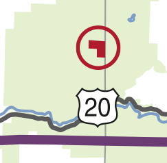
BLM To Sell National Forest Land. This 120-acre parcel of “BLM” land (left) is not only surrounded by the Willamette National Forest (the green on the map), but is the Willamette National Forest. BLM doesn’t own it, but, since it is on the official map, S.1784 would require them to sell it.

Salmon and Botanical Values. These 21.21-and 202.34-acre O&C parcels (right) slated for disposal in the S.1784 would otherwise be included in S.1784’s “Illinois Valley Salmon and Botanical Area.” That latter provision is elsewhere in the bill and references another map. Part of the larger parcel is designated by BLM as an Area of Critical Environmental Concern (ACEC).
Adjacent to National Wild and Scenic River. This 80-acre PD parcel (left) abuts the Chetco Wild and Scenic River, designated by Congress in 1988. The green in the map is Siskiyou National Forest land. The other 40-acre square of yellow is BLM PD just as far away from the BLM office, but the agency didn’t put it on the chopping block.

Rare Coastal Habitat. The yellow BLM land (left) on the North Spit of Coos Bay, adjacent to the Pacific Ocean that BLM doesn’t want to dispose of is next to two (92.78 and 96.15 acres) parcels of PD that the agency does want to dispose of. The third 80-acre parcel abuts not only the Siuslaw National Forest, but also the Oregon Dunes National Recreation Area that Congress designated in 1974.
Orphans of History. These eight parcels of PD land (7.6, 40, 111.5, 84.3, 40.62, 40, 210.21 and 40 acres) are surrounded on one to all sides by the Siuslaw National Forest. The ninth PD parcel to the north (40 acres) is on the Alsea Estuary.
There are other examples of ill-advised land sales that would be required in S.1784. Nonetheless, are certainly some lands—both Zone 3 and others—that are of low-conservation value where the revenues of sale from those lands could result in acquiring lands with higher conservation values. A comprehensive analysis could be done and then those lands specifically be identified in the legislation.
14. Result in the Death of Collaboration
In its usual sense pertaining to public forest management, collaboration is a process by which diverse stakeholders come together and develop and monitor projects upon which stakeholders agree. Over the past decade, this process has become more common on both Forest Service and BLM lands, leading to increased scale and pace of forest ecosystem and watershed restoration.
In its 188 pages, S.1784 uses the word collaborate or a derivation three times, twice in the context of language that would effectively encourage, if not require, the US Fish and Wildlife Service to capitulate to BLM in matters pertaining to implementation of the Endangered Species Act and once in the context of monitoring of logging and other activities required by S.1784.
In contrast, Senator Wyden’s “Oregon Eastside Forests Restoration, Old Growth Protection and Jobs Act (S.1301, introduced 17 July 2013) use the word collaborate or a derivative 23 times in 38 pages, always in a positive context of facilitating cooperation of diverse stakeholder interests to reach mutually agreeable ecological restoration projects.
If enacted into law S.1784 will be the death knell of collaboration on western Oregon BLM lands that may well spread to adjacent National Forest System lands. Collaboration is built upon trust between agencies and stakeholders, and is rooted in the landscape approach to public lands management embraced by the NWFP. Without these elements, and with conservationists spending time defending environmental laws and other resources put at risk by S.1784, time and energy to work with the BLM and the Forest Service will likely be reduced significantly.
S.1784 doesn’t guide public forest management by setting reasonable and enforceable sideboards and then letting professional managers, in consultation with stakeholders, manage the forest. Rather S.1784 would micromanage so that timber sales are orchestrated to get the cut out at any cost.
The result, besides being bad for the forest, will repolarize public forest management in Oregon. If S.1784 is enacted into law, conservation interests won’t have time to collaborate and timber interests won’t have to.
15. Reignite the Oregon Forest Wars
The social license in Oregon to log “older” forests for purely commercial reasons no longer exists. While guised in ecological-forestry reasoning, S.1784 defines “older trees” as those between 100 and 150 years of age on the date of enactment (pity the 99-year-old tree and its progressively younger siblings) and urges—but does not require—that these elders be spared in logging operations that could otherwise leave them standing alone, if not lonely.
Nor does the social license to clearcut (or anything that looks like it even if called something different) exist on federal public forestlands. The nation’s founders did not use the words “slave” or “slavery” in the Constitution in 1978, but the Constitution nevertheless condoned it until 1865. If “variable retention regeneration harvests” sounds a lot like three-fifths of a person, that’s because it is at least three-fifths of a clearcut. Legislating an unjust practice does nothing to make people tolerate it.
The social license to road and log—by whatever method—roadless areas (>1,000 acres in size) also has expired and will not be renewed.
If S.1784 is enacted and tries to once more force these practices upon the public, litigation will increase. Protests—be they in the streets or in the trees or in the offices of elected and appointed officials—will increase.
The proposed legislation would have made more sense if it had been introduced in 1990. It is a 20th Century solution that neither gives the O&C counties the money they want nor the timber industry the logs they want. It does split the baby, something that many commentators on modern politics tend to deem good. Of course, a split baby—no matter how carefully politically crafted—is still two halves of a dead baby.
At its core, S.1784 would legalize industrial logging that is today either:
• illegal (due to the nation’s bedrock environmental laws, including but not limited to the Endangered Species Act); and/or
• socially unacceptable.
An Act of Congress can legalize logging that is now illegal, but it cannot restore a social license for logging that is now immoral.
The Ugly
The Ugly
Some things are beyond bad and just downright ugly. When considering what is “the ugly” in S.1784, we limit the category to only the most egregious and horrendous of egregious and horrendous offenses against public lands and the public interest. In the case of the DeFazio-Walden O&C legislation, examples would be the effective privatization of 1.7 million acres of federal public forestlands and at the loss on the federal balance sheet on the order of $8-10 billion dollars. There is only one downright ugly provision of S.1784. However, this provision so odious and nefarious as to undermine and negate anything supposedly good in the legislation.
(It bears repeating here that the only reasonable and prudent way to evaluate legislative language is to read it in the worse possible light. English can often be ambiguous and the American legislative process has perfected the art of promulgating such ambiguity so as to be able to write legislation that can do without actually saying so or to say without actually doing so. The following may not be the intent of Senator Wyden. It may be a case of poor drafting or honest oversight. One hopes. However, with legislative language, one should not rely on hope.)
1. Land Exchanges
Sec. “117” of S.1784 addresses “land ownership consolidation.” As the charge of being “ugly” is a serious one, below I walk through each provision of the exchange authority and how it could be interpreted by an Administration hostile to conservation in particular and public lands in general. Such administrations have existed in the past (Harding, Coolidge, Hoover, Eisenhower, Reagan, Bush and Bush) and could again (Peter King, Michelle Bachman, John Barrasso, Ted Cruz, Jim DeMint, Lindsay Graham, Bobby Jindal, Sarah Palin, Rand Paul, Rick Perry, Rick Santorum, etc.). Nothing since has changed the circumstances that allowed a revolving door between timber industry members and members of such administrations.
S.1784 first directs BLM (“The Secretary”) to consolidate federal and non-federal land and lists three reasons to consolidate.
(a) The Secretary shall seek to consolidate Federal and non-Federal land by conveying the covered land and by acquiring private or State-owned land to create more contiguous blocks of land under the jurisdiction of the Secretary—
‘‘(1) to improve the efficiency of management of the Federal land;
‘‘(2) to facilitate resource management on the Federal land; or
‘‘(3) to improve the conservation value of the Federal land. [emphasis added] (Sec. “117(a))
Then it directs BLM to review and identify lands that could be disposed of to meet any of the three purposes in subsection (a).
(b) Not later than 180 days after the date of enactment of the Oregon and California Land Grant Act of 2013, the Secretary shall review and inventory the covered land to identify any public land that—
(1) as the result of location or other characteristic, is no longer necessary or appropriate for continued Federal management in accordance with this Act; or
(2) is determined to facilitate achieving any of the purposes described in subsection (a). [emphasis added] (Sec. “117(b))
Subparagraph (b) refers to “covered land,” defined in S.1784 as “Oregon and California Railroad and Coos Bay Wagon Road grant land” managed by BLM) and clause (b)(1) would seem to prevent BLM from finding that any “covered land” S.1784 would designate (or already is designated) as wilderness, wild & scenic river, national monument, old growth legacy network, national recreation area, drinking water special management unit, drinking water protection area, national scenic trail corridor, primitive backcountry area, and/or special environmental management zone—however, if there is to actually be any covered land available for exchange, those designated solely conservation emphasis area or forestry emphasis area [and the RRs within them]) appear to be eligible for exchange or sale.
Subparagraph (b)(2) is separated from (b)(1) by an “or” not an “and” so only one condition must be met by BLM.
Subparagraph (c) sets up adjacent landowners as the target for exchange:
(c) As soon as practicable after completing the review and inventory under subsection (b), the Secretary shall consult with the owners of adjacent land to determine whether there is mutual interest in entering into land exchanges if the exchange will meet any of the purposes described in subsection (a). [emphasis added] (Sec. “117(c))
Such an exchange only must meet one criterion: improve efficiency, facilitate resource management or improve conservation of federal lands.
S.1784 then provides for “expedited land exchanges” initiated by an adjacent landowner:
(d)(1) If an owner of adjacent land described in subsection (c) expresses interest in participating in a land exchange under this section, the Secretary may complete that land exchange in accordance with paragraphs (2) through (5). [emphasis added] (Sec. “117(d)(1))
If such an exchange is proposed, BLM must make a “public interest determination” and if not promptly done, the agency is harassed monthly until it does:
(A) If an owner of adjacent land described in subsection (c) proposes to the Secretary entering into a land exchange under this section, the Secretary shall, not later than 90 days after receiving the proposal, determine whether the public interest will be well-served by making the exchange.
(B) If the Secretary fails to make the determination by the date described in subparagraph (A), the Secretary shall submit to the Committee on Energy and Natural Resources of the Senate and the Committee on Natural Resources of the House of Representatives—
(i) a report explaining the reason why the determination has not been made; and
(ii) every 30 days after the report described in clause (i) is submitted until the date on which the Secretary makes a determination, an updated report. [emphasis added] (Sec. “117(d)(2))
Assuming BLM makes a positive public interest determination, the land exchange will go forward pending completion of appraisals:
(3) If the Secretary determines that a proposed land exchange is in the public interest, the Secretary may allow for the Federal and non-Federal land to be exchanged pending completion of appraisals, subject to a binding commitment from a non-Federal landowner and any terms and conditions that Secretary may require to ensure the values of the Federal and non-Federal land are ultimately equal or equalized in accordance with Section 206(b) of the Federal Land Policy and Management Act of 1976 (43 U.S.C. 1716(b)).
(4) In order to expedite a land exchange that the Secretary has determined to be in the public interest under paragraph (2), the Secretary may use the authority to exchange land of approximately equal value in accordance with section 206(h) of the Federal Land Policy and Management Act of 1976 (43 U.S.C. 1716(h)) as applicable. [emphasis added] (Sec. “117(d)(3)&(4))
Finally the exchange provision of S.1784 confers additional authority for land exchanges beyond the manner prescribed in this bill by extending existing authority for National Forest System land exchanges to the covered lands:
(5) The Secretary may exercise the authority under the Act of March 20, 1922 (16 U.S.C. 485), to facilitate land exchanges under this section, except that any reference to the Secretary of Agriculture in that Act shall be considered to be a reference to the Secretary, and any reference to national forests in that Act shall be considered to be a reference to covered land. [emphasis added] (Sec. “117(d)(5))
The referenced provision says:
When the public interests will be benefited thereby, the Secretary of Agriculture is authorized in his discretion to accept on behalf of the United States title to any lands within the exterior boundaries of the national forests which, in his opinion, are chiefly valuable for national-forest purposes, and in exchange therefor may patent not to exceed an equal value of such national-forest land, in the same State, surveyed and nonmineral in character, or he may authorize the grantor to cut and remove an equal value of timber within the national forests of the same State; the values in each case to be determined by him. ….. Timber given in such exchanges shall be cut and removed under the laws and regulations relating to the national forests, and under the direction and supervision and in accordance with the requirements of the Secretary of Agriculture. Lands conveyed to the United States under this section and section 486 of this title shall, upon acceptance of title, become parts of the national forest within whose exterior boundaries they are located. [emphasis added] (16 U.S.C. 485)
BLM lands in Western Oregon don’t have an “exterior boundary.” They either are “covered lands” (O&C or CBWR) or they are not. National Forests have proclaimed exterior boundaries in which all federal land became lands administered by the Forest Service, but often had nonfederal lands within them, which is the reason for this exchange authority.
In addition, to facilitate a land exchange under S.1784 BLM could buy private land with public timber. The federal government would receive no monies, so no revenues would be shared with the counties. Liquidating forests on public lands that are generally older than those to be acquired on private lands is generally not a good idea.
Here’s the worst-case implementation of the exchange authority of S.1784:
A. A profit-maximizing corporation (it’s what the law general requires of them) offers BLM its private lands in “exchange” for BLM “covered land.”
B. The selected BLM federal public forestlands have high conservation value (which is directly correlated to high timber values (e.g. old growth forest) and includes “covered land” that has been designated Wilderness and is also Wild and Scenic River and part of the Old Growth Legacy Network.
C. BLM finds the proposed exchange to be in the “public interest” because it would “facilitate resource management,” “improve efficiency of management” or “improve the conservation value” (it need not be more than one).
D. The exchange is “expedited” in that titles are exchanged before any money (or logs) exchanges hands.
Coinciding with such an anti-conservation/anti-public lands administration could be a Governor of Oregon and a congressional delegation that, if not bought and sold by the timber industry, they are at least rented and leased (plentiful historical precedent exists).
The example is extreme to make a point. If such an outrageous raid on the National Wilderness Preservation System and/or National Wild and Scenic Rivers System were to be attempted, one would hope that public backlash would be swift, severe and adequate. In this extreme example, it might well be. But in the case of a less-extreme example, it may not be. In any case, even the possibility of such an abusive giveaway of public assets should not be allowed. As there is no requirement for public comment on such an exchange, the probabilities for such abuse increase greatly with no "public interest" standard other than “facilitate resource management” or “improve efficiency of management.”
Is this land exchange provision of S.1784 intentionally drafted to be a Trojan Horse? Was it merely poor drafting or honest oversight? Did Senator Wyden mean to include an “and” rather than an “or” at:
‘‘(1) to improve the efficiency of management of the Federal land;
‘‘(2) to facilitate resource management on the Federal land; or
‘‘(3) to improve the conservation value of the Federal land.
Did Senator Wyden mean to limit the applicability of lands available for exchange to those “covered lands” both “no longer necessary or appropriate for continued Federal management in accordance with this [S.1784]” and “determined to facilitate achieving any all of the purposes described…” [emphasis added and wording change suggested]. A land exchange simply must have a determination made before it can be done; it is not conditioned on being consistent with such a determination.
1 http://www.wyden.senate.gov/priorities/oc-act-of-2013
2 S.1784,IS 113th Congress.
3 H.R. 1526, 113th Congress.
4 includes 18 “O&C” counties in “western Oregon), which are all counties—save Clatsop—west of the Cascade Crest and also Klamath County east of the Cascade Crest.
5 S.1784 addresses certain National Forest System (NFS) lands, managed by the Forest Service (USFS) by designating some as Wilderness and Wild & Scenic Rivers. These USFS acres are not included in this analysis because the legislation doesn’t comprehensively address all NFS lands and the bill otherwise exclusively addresses BLM lands. If these USFS O&C acres designated as Wilderness and Wild & Scenic Rivers were to be counted as “good” acres, they would be more than be offset by ~500,000 acres of “bad” acres in that the senator’s “O&C” legislation leaves USFS O&C classified as “O&C” lands, which is bad.
6 Of the ~2.6 million acres of Western Oregon BLM lands, currently 1.55% are in the National Wilderness Preservation System (Wild Rogue, Table Rock and Soda Mountain). With these additions, the total would rise to 2.57% for a total of 4.12%. While it could be spun as a 166% increase in BLM Wilderness in Western Oregon, a more accurate representation of the situation is that 25 times more acres are not Wilderness than are Wilderness.
7 ~23,600 acres are USFS lands for a total of ~30,400 acres.
8 An additional 5.9 miles of Wasson Creek and 4.5 miles of Franklin Creek would also be designated as Wild and Scenic River in S.1784, but are not counted herein because they are on National Forest System lands managed by the Forest Service.
9 Both on National Forest System lands, the bill also renames an existing Wild and Scenic River and reclassifies portions of the Chetco Wild and Scenic River to be more protective and withdraws the entire Chetco WSR from application of the mining laws, so mileages are not counted here.
10 “But this long run is a misleading guide to current affairs. In the long run we are all dead. Economists set themselves too easy, too useless a task if in tempestuous seasons they can only tell us that when the storm is long past the ocean is flat again.” John Maynard Keynes in A Tract on Monetary Reform (1923).
11 Written Statement of Seven A. Ellis, Deputy Director of Operations, Bureau of Land Management, Department of the Interior on S.1784, the Oregon and California Land Grant Act of 2013. February 6, 2014
12 Oral Statement of Sen. Ron Wyden. Hearing on S.1784, the Oregon and California Land Grant Act of 2013. February 6, 2014.
13 USDI Bureau of Land Management and USDA Forest Service. 1994. Standards and Guidelines for Management of Habitat for Late-Successional and Old-Growth Forest Related Species Within the Range of the Northern Spotted Owl; Attachment A to the Record of Decision for Amendments to Forest Service and Bureau of Land Management Planning Documents Within the Range of the Northern Spotted Owl.
Appendix A: Disposition of the O&C Lands Act of 1937 (As Amended) by S.1784
|
Disposition Under S.1784 |
Current Provision of the United States Code |
|
Repealed and Replaced |
43 U.S. CODE § 1181A - CONSERVATION MANAGEMENT BY DEPARTMENT OF THE INTERIOR; PERMANENT FOREST PRODUCTION; SALE OF TIMBER; SUBDIVISION |
|
Retained and Renumbered |
43 U.S. CODE § 1181B - COOPERATIVE AGREEMENTS WITH OTHER AGENCIES OR PRIVATE OWNERS FOR COORDINATED ADMINISTRATION |
|
Retained and Renumbered |
43 U.S. CODE § 1181D - LEASING OF LANDS FOR GRAZING; DISPOSITION OF MONEYS; RULES AND REGULATIONS COVERING GRAZING LANDS |
|
Retained and Renumbered |
43 U.S. CODE § 1181E - RULES AND REGULATIONS GENERALLY; CONSULTATION AND AGREEMENTS WITH OTHER AGENCIES REGARDING FIRE REGULATIONS |
|
Amended* |
43 U.S. CODE § 1181F - OREGON AND CALIFORNIA LAND-GRANT FUND; ANNUAL DISTRIBUTION OF MONEYS |
|
Retained |
43 U.S. CODE § 1181G - UNSELECTED AND UNPATENTED ODD-NUMBERED SECTIONS AS REVESTED GRANT LANDS; ADMINISTRATION AS NATIONAL-FOREST LANDS; REVENUES; PROHIBITION AGAINST DISPOSITION OR EXCHANGE |
|
Retained |
43 U.S. CODE § 1181H - EXCHANGE OF JURISDICTION BETWEEN SECRETARIES; CONDITIONS; PUBLICATION IN FEDERAL REGISTER |
|
Retained |
43 U.S. CODE § 1181I - DESIGNATION OF NATIONAL-FOREST AREAS WITHIN COUNTIES; DISPOSITION OF REVENUES; APPROVAL BY COURT |
|
Retained |
43 U.S. CODE § 1181J - APPROPRIATIONS TO CARRY OUT |
|
*Effectively repealed and replaced. |
|
Appendix B: Additions to the National Wild & Scenic Rivers System in S.1784
|
|
Wild & Scenic River |
|
|||
|
Stream Segment |
Total |
Wild |
Scenic |
Recreational |
No Mining/ Dams |
|
Lower Rogue WSR Additions Associated with Wild Rogue Wilderness Additions Long Pending in Congress |
|||||
|
Kelsey Creek |
4.8 |
4.8 |
|
|
4.5 |
|
East Fork Kelsey Creek |
4.6 |
4.6 |
|
|
0.2 |
|
Whisky Creek |
2.5 |
1.9 |
|
0.6 |
|
|
East Fork Whisky Creek |
2.9 |
2.6 |
|
0.3 |
0.9 |
|
West Fork Whisky Creek |
4.8 |
4.8 |
|
|
|
|
Big Windy Creek |
7.3 |
5.8 |
1.5 |
|
|
|
East Fork Big Windy Creek |
3.9 |
3.7 |
0.2 |
|
|
|
Little Windy Creek |
1.9 |
1.9 |
|
|
1.2 |
|
Howard Creek |
7.2 |
6.9 |
0.3 |
|
|
|
Mule Creek |
6.3 |
6.3 |
|
|
5.1 |
|
Anna Creek |
3.5 |
3.5 |
|
|
|
|
Missouri Creek |
1.6 |
1.6 |
|
|
3.1 |
|
Jenny Creek (Josephine County |
1.8 |
1.8 |
|
|
3.1 |
|
Rum Creek |
2.2 |
2.2 |
|
|
2.2 |
|
East Fork Rum Creek |
1.3 |
1.3 |
|
|
0.8 |
|
Wildcat Creek |
1.7 |
1.7 |
|
|
|
|
Montgomery Creek |
1.8 |
1.8 |
|
|
|
|
Hewitt Creek |
1.2 |
1.2 |
|
|
1.4 |
|
Bunker Creek |
6.6 |
6.6 |
|
|
|
|
Dulog Creek |
1.0 |
1.0 |
|
|
|
|
Quail Creek. |
1.7 |
1.7 |
|
|
0.8 |
|
Meadow Creek |
4.1 |
4.1 |
|
|
|
|
Russian Creek |
2.5 |
2.5 |
|
|
0.1 |
|
Alder Creek |
1.2 |
1.2 |
|
|
|
|
Booze Creek |
1.5 |
1.5 |
|
|
|
|
Bronco Creek |
1.8 |
1.8 |
|
|
|
|
Copsey Creek |
1.5 |
1.5 |
|
|
|
|
Corral Creek |
0.5 |
0.5 |
|
|
|
|
Cowley Creek |
0.9 |
0.9 |
|
|
|
|
Ditch Creek |
1.8 |
1.8 |
|
|
0.7 |
|
Francis Creek |
0.9 |
0.9 |
|
|
1.4 |
|
Long Gulch |
1.1 |
1.1 |
|
|
|
|
Bailey Creek |
1.7 |
1.7 |
|
|
1.4 |
|
Shady Creek |
0.7 |
0.7 |
|
|
|
|
Slide Creek |
1.2 |
0.7 |
0.5 |
|
|
|
Quartz Creek |
0.0 |
|
|
|
3.3 |
|
North Fork Galice Creek |
0.0 |
|
|
|
5.7 |
|
Grave Creek |
0.0 |
|
|
|
10.2 |
|
Centennial Gulch |
0.0 |
|
|
|
2.2 |
|
Galice Creek |
0.0 |
|
|
|
2.2 |
|
Subtotals (Wild & Scenic Rivers) |
92.0 |
88.6 |
2.5 |
0.9 |
|
|
Subtotals (No Mining/No Damming) |
|
|
|
|
50.5 |
|
Associated with Devils Staircase Wilderness Long-Pending in Congress |
|||||
|
Wasson Creek |
4.2 |
4.2 |
|
|
|
|
Long-Pending in Congress |
|||||
|
Molalla |
21.3 |
|
|
21.3 |
|
|
First Time Introduced in Congress |
|||||
|
Nestucca |
15.0 |
|
|
15.0 |
|
|
Walker Creek |
3.0 |
|
|
3.0 |
|
|
North Fork Silver Creek |
6.0 |
|
|
6.0 |
|
|
Jenny Creek (Jackson County) |
20.0 |
|
20.0 |
|
|
|
Spring Creek |
1.0 |
|
1.0 |
|
|
|
Lobster Creek |
6.0 |
|
|
6.0 |
|
|
Subtotals |
51.0 |
0.0 |
21.0 |
30.0 |
|
|
GRAND TOTALS |
168.5 |
92.8 |
23.5 |
52.2 |
50.5 |